Leader: Dick Bryant
Saturday October 7th, 2023
Coordinator: Bob Timmer
Trip Recap
Eleven ASCO members met ASCO’s Dick Bryant in Sisters and began the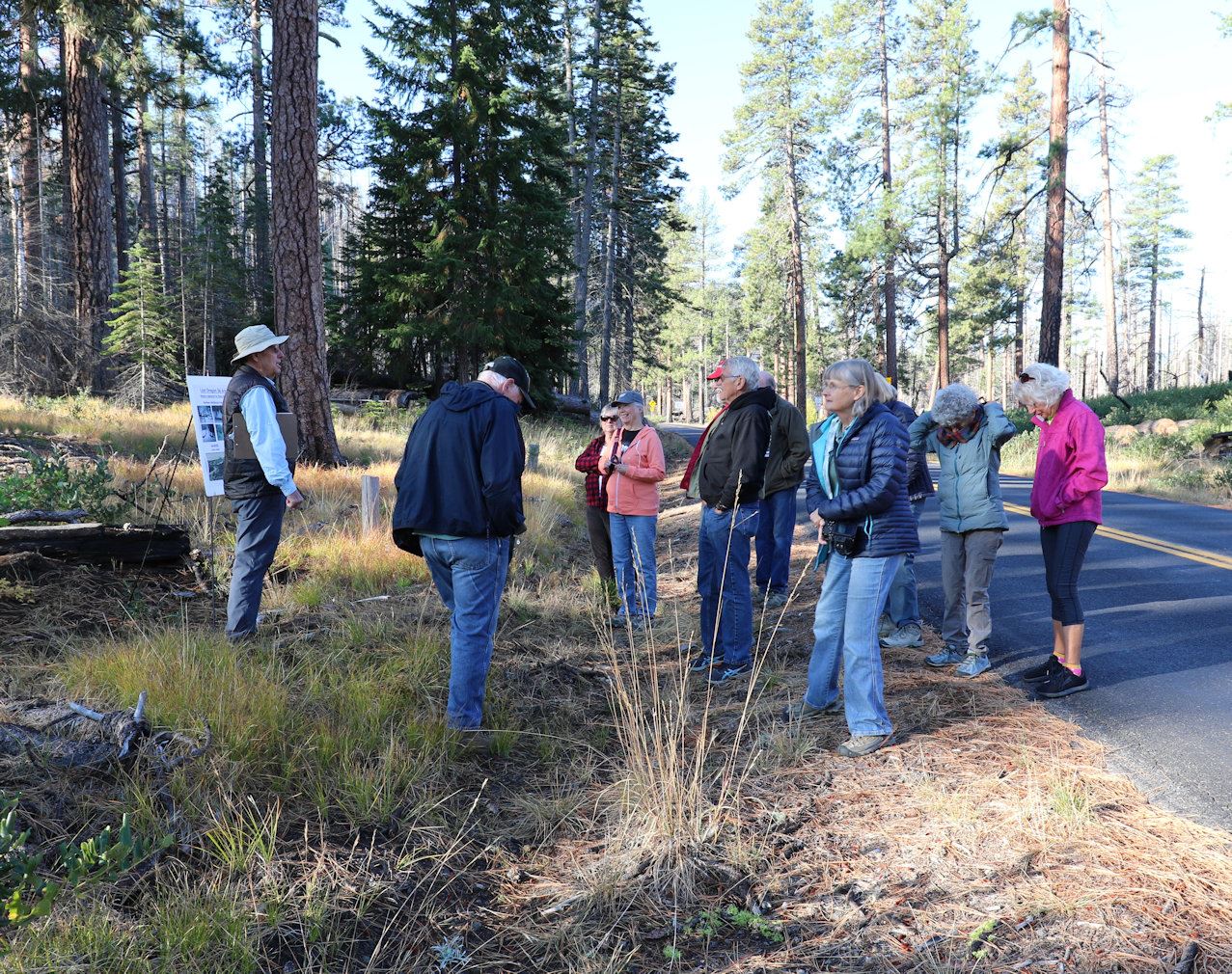 journey along highway 242 and the McKenzie Toll Road. At the first stop, 8 miles from Sisters, ASCO’s Bob Timmer pointed to where the Skyliners built a ski jump, a toboggan run and a warming shelter in 1928; showing photos from Steve Stenkamp’s Lost Oregon Ski Areas facebook page.
Continuing on, the group was pleased to find the air calm at Windy Point; thanking Dick for arranging such a nice, bluebird day! Dick spoke to the history of two toll roads built 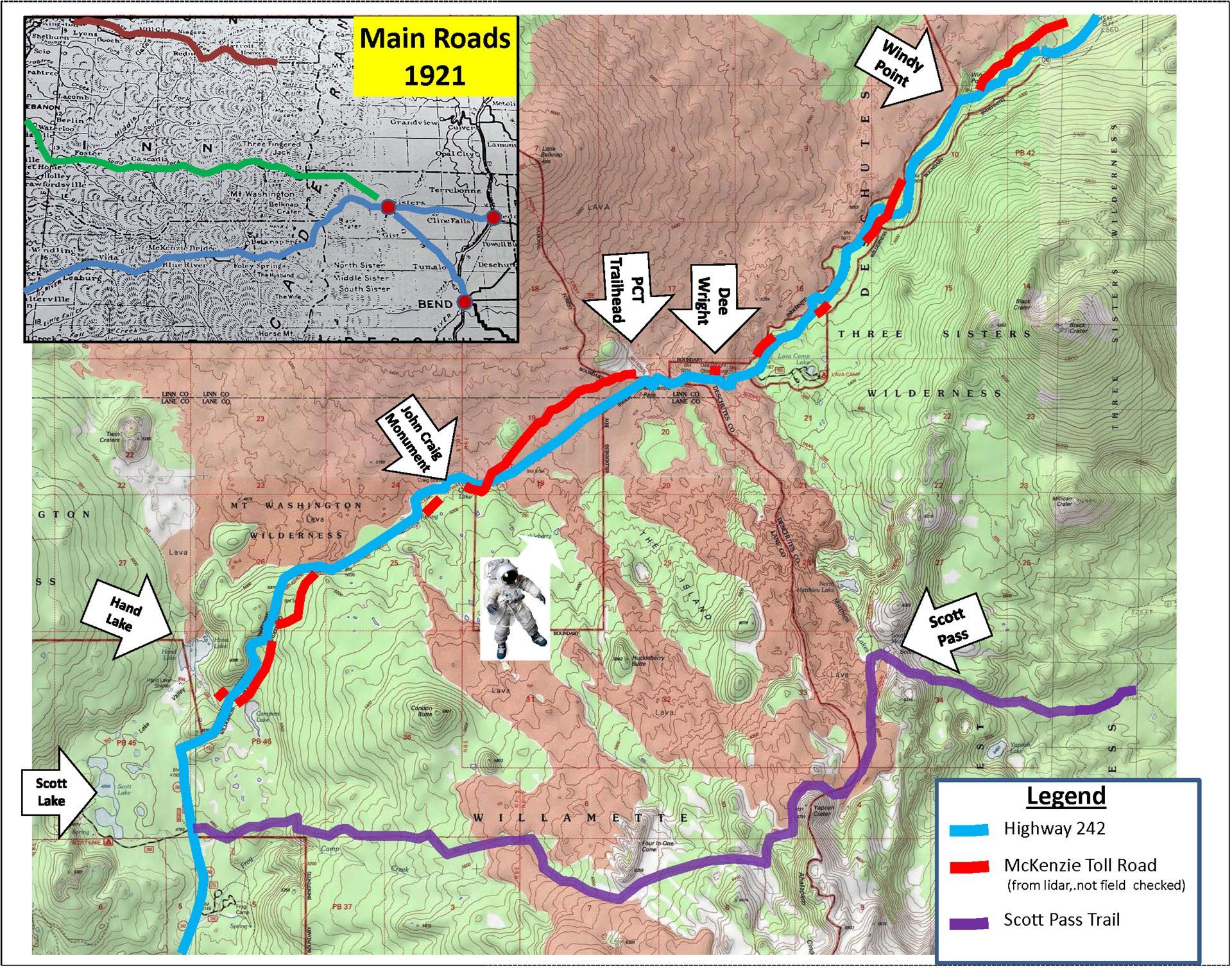 to enable transport meat and supplies from the Willamette Valley to residents of Central Oregon and the gold fields at John Day. The first, was established in 1862 by Felix Scott jr. and the second by John Craig in 1872. Craig, believing his route was superior due to its lower elevation, formed the McKenzie, Salt Springs & Deschutes Wagon Road Company in 1871 and the McKenzie Toll Road opened the following year. In 1898, the road was transferred to the county after collecting some $18,000 in tolls over the years, $539,000 in today’s $’s. In 1917, it was reconstructed to the highway 242 we are driving today. The Clear Lake cutoff was completed in 1962; enabling year-round travel from Sisters to Eugene.
Bob presented an overview of how Lidar (Light Detection and Ranging) can be utilized to help image features such as stretches of the now abandoned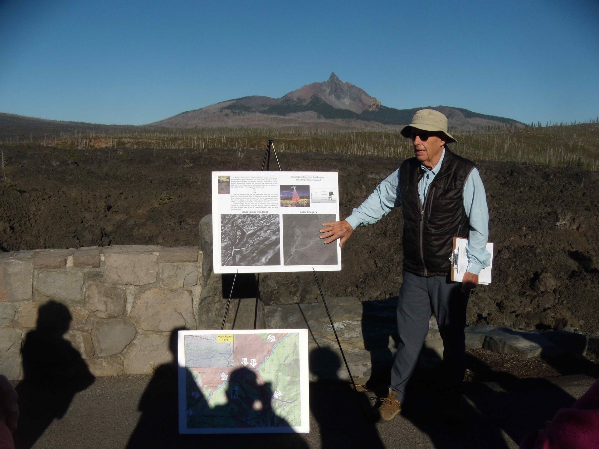 toll road. Click HERE to view the posters. The Oregon Division of Geology and Mineral Resources (DOGAMI) maintains a online repository and viewer for Lidar data.
Continuing on to the Dee Wright Observatory, Dick spoke briefly about its history; being constructed by the CCC from 1933 to 1935 and being named for Dee, who was the initial supervisor for the construction. Just another ½ mile down 242, at the PCT trailhead, Dick led the group on a ¼ mile hike onto a section of the 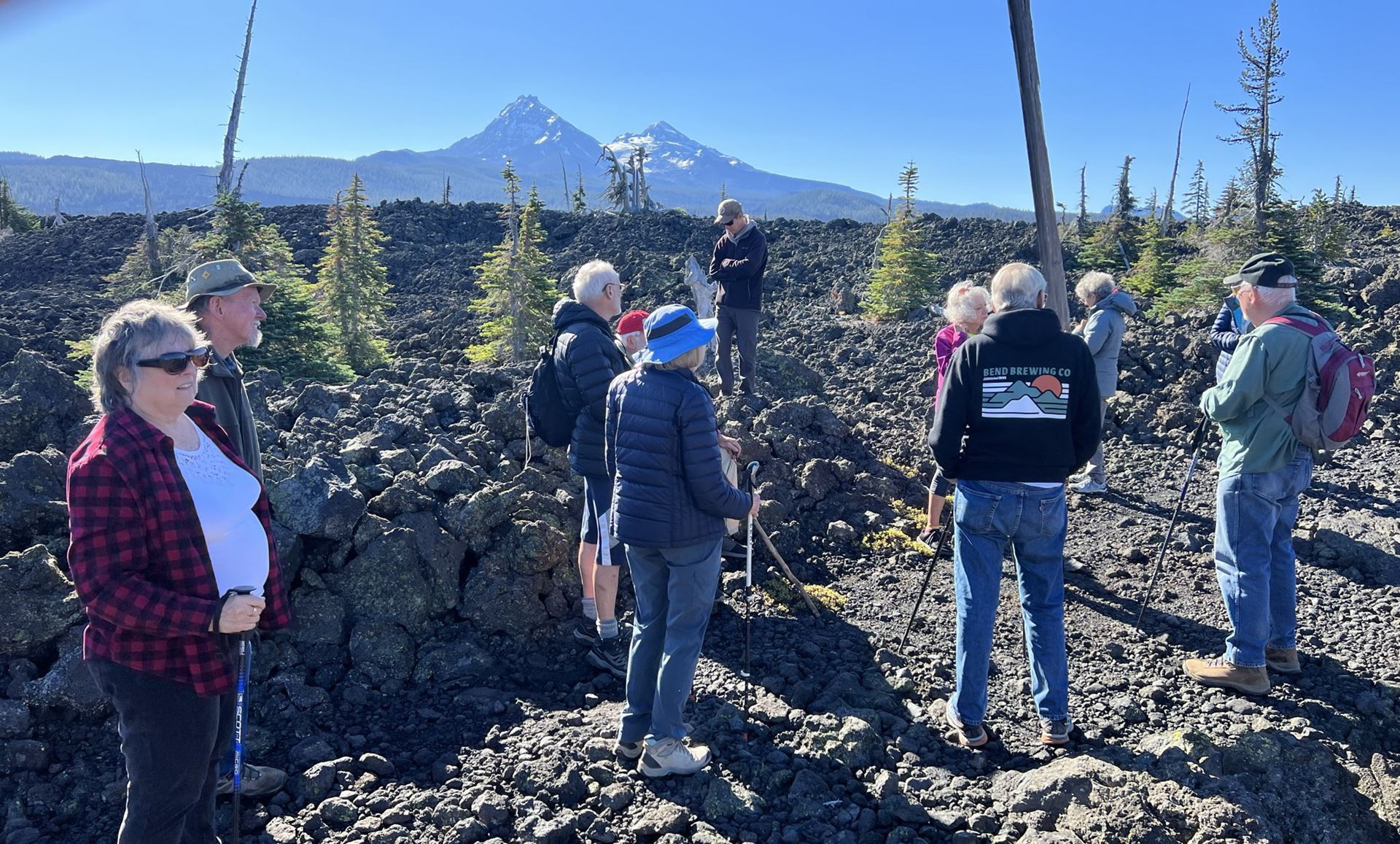 road heading across the lava. Walking along it, one really gets a sense of how much work went into constructing the road and what travel along it would have entailed. A few cedar poles remain standing along the road.
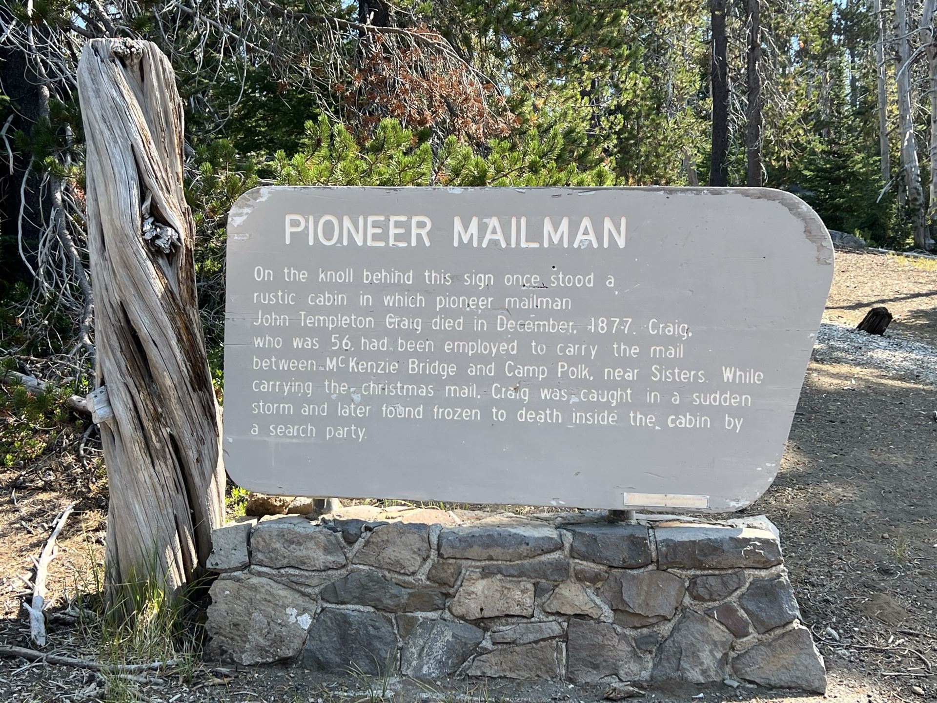
The next stop was the memorial and grave of John Craig. Craig carried the mail, on horseback in the summer and on skis in the winter, from Eugene over the Mckenzie Pass to Camp Polk to his untimely death in December 1877. Dick mused that given the long life of the McKenzie Toll Road,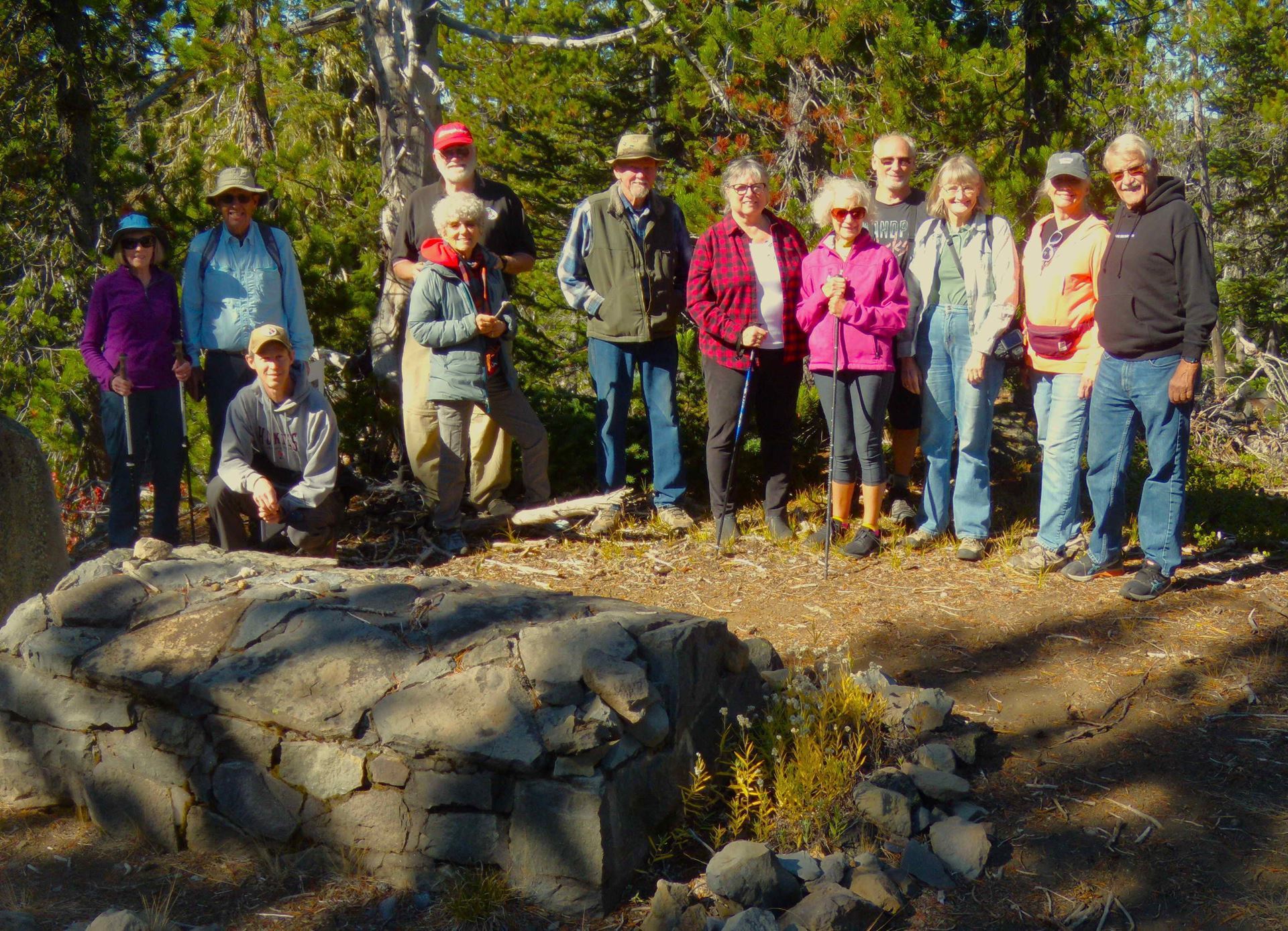 started by Craig, versus the short life of the Scott Road, started earlier by Feliz Scott, it is surprising that only Craig Lake caries his name whereas there is Scott Lake, Scott Pass, Scott Mountain ,and Scott Trail
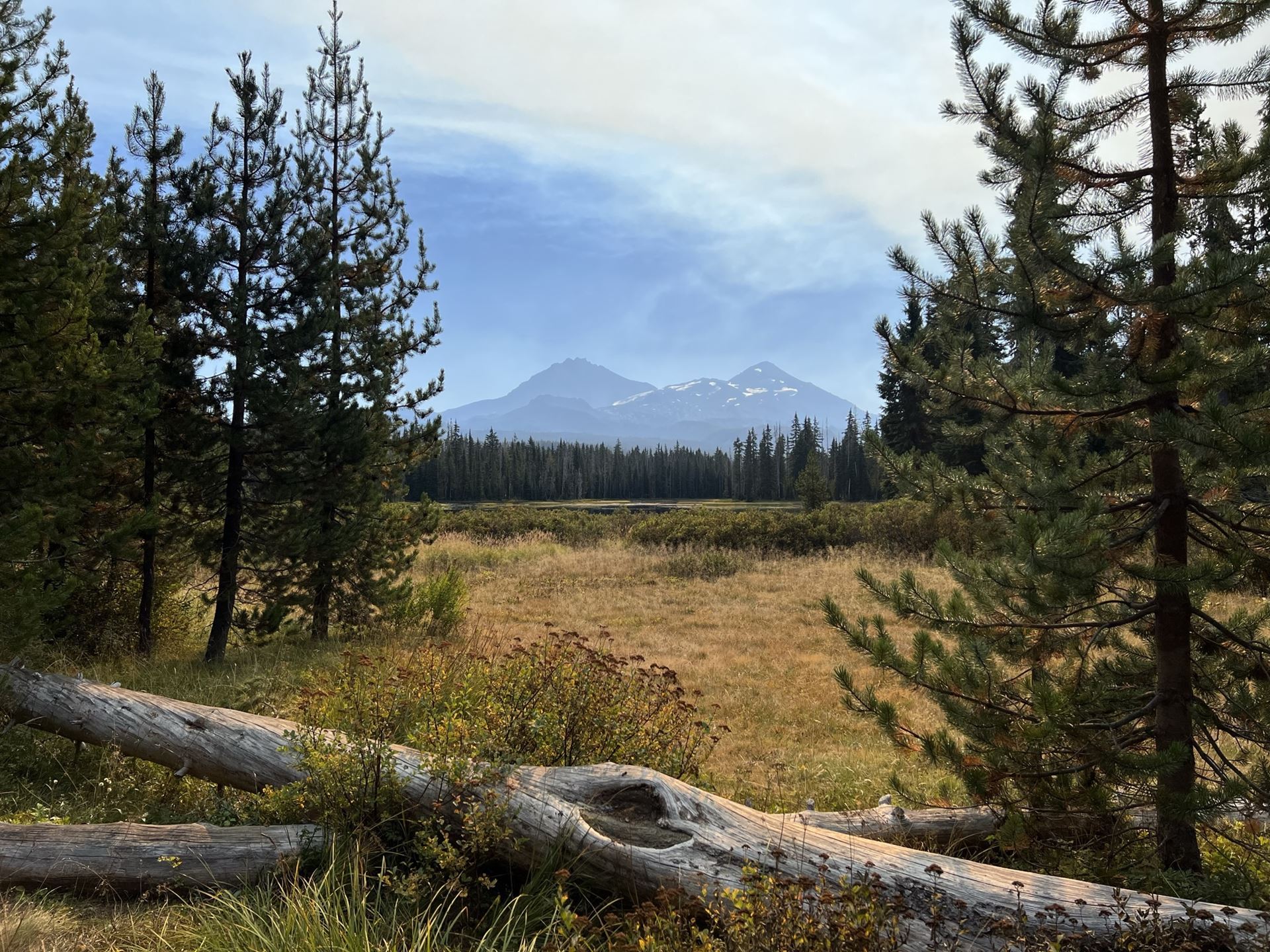
The last stop before lunch along the shore of Scott Lake, was at the trailhead for what is now Scott Trail but in 1862 was the start of Scott Road. Felix Scott led a crew of 50 men to blaze a trail across the Cascades following an old Indian trail that skirted the lava flows. The trail 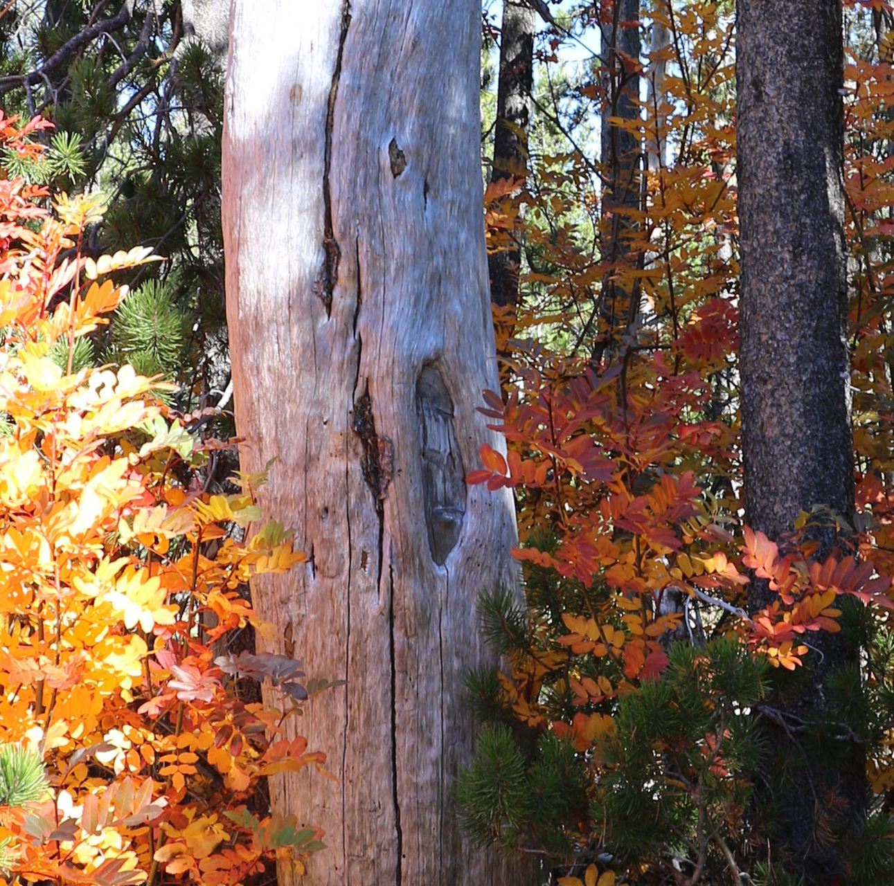 was difficult for wagons and, at 1,000 feet higher than Windy Point, the pass retained snow much later in the spring. Dick showed the group several old blazes in the trees; pointing out distinctive cut marks in the blaze.
Thanks to Scott McKenzie for some of the photos

Trip Anouncement
Limited to 15 Participants
The McKenzie Pass Toll Road started in 1862 as a way for freight wagons, pack horses and live stock to get from the Willamette Valley to Central Oregon. The person that started the road was a fellow by the name of Felix Scott. His route avoided going thru the extensive lava fields at the summit of the pass. Instead he crossed the crest further south up near the north side of the north sister. This route was about 1000 feet higher in elevation. Because of this the road was impassible much longer in the year due to the heavier snow pack. This made it impractical, so it became unusable due to lack of maintenance. In 1872 fellow by the name of John Craig formed a new company, which took over the road. He rerouted the higher portions thru the lower lava fields. Much of the old road thru the lava is visible today.
Itinerary
Meet: Bi Mart parking lot in Sisters. East side near the highway. Arrange for rides
Time: 8:30 AM
Here are the stops:
*Mileage 0.0 - Leave Sisters, Drive up Highway 242 towards the Pacific Crest trailhead
* Mileage 8.0 (pull-off on right) Site of Bend Skyliners ski jump, toboggan run, and small lodge established in 1928

* Mileage 11.3 (pull-off on right) Windy Point
* Mileage 14.7 (pull-off on right) Dee Wright Observatory constructed in 1933-34. Vault toilet
* Mileage 15.2 (pull-off on right) PCT Trailhead on north side of highway. We will hike approximately 300 yards to the east entrance to the old toll road as it ascends into the lava fields and then about another 150 yards along the old toll road. Total round-trip distance 1/2 miles.

*Mileage 16.7 (pull-off on left) - Craig Lake. Possible walk about 1/2 mile to west entrance to the wagon road across the lava fields.

*Mileage 17.0 (pull-off on left) John Craig monument
*Mileage 20.7 (turn-off on right) Scott Lake turnoff and Scott Trailhead. Park at the trailhead. We will follow the trail across the highway for a short distance. This would be the route of the original Felix Scott road.

*Continue drive into Scott Lake and park on left side of road at the Bensen/Tenas Lakes Trailhead. Vault toilets. We will walk to one of the walk-in picnic tables along the west side of Scott Lake for lunch. We will take in the view and hike a short distance along the north side of the lake. This would have probably been the re- route as developed by John Craig.
*End of Field Trip - Stop at the Dee Wright Observatory if desired.
*Arrive Sisters. Visit the Sisters Coffee House if moved to have a cup of Joe.
NOTES OF CAUTION!!!!
*When driving to the summit of McKenzie Pass via highway 242, be aware! The road is narrow, with no shoulders. It has a lot of tight curves with short sight distances. You might encounter bicyclists ascending the pass, and they will be in your lane. Be extremely careful in passing as there may be traffic coming down. Hopefully an early start will eliminate much of this problem.
* Should be cool but bring a hat.
* The old road thru the lava is walk able, but stout hiking shoes and hiking poles are recommended.
* Bring water a lunch and a camera.