Tumalo Dam & 1914 Wimer Ranch Field Trip
May 13, 2022
by Mike Berry
Trip Recap
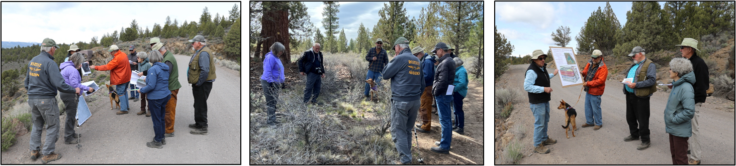
Using a survey map from 1913, Mike Berry led the group on an exploration of the Wimer ranch; a homestead from the late 1800's that was purchased by the state of Oregon and abandoned in 1914. A few scattered boards, cans, a pit that might have been a root cellar, a few fence posts and one tall post at the site of the old barn, are what is left of the occupation. Looking across the expanse of sagebrush now present in Bull Flat, it is hard to visualize that the area was fields of wheat & oats, alfalfa, clover, and pasture just a hundred years ago. With the help of the survey map, we traced the course of shallow irrigation canals that otherwise wouldn't be noticed. Vegetation along the canals is a bit greener. A few cans and boards amongst the sagebrush are all that marks the site of the original Tumalo Post Office.
Further down the road, Mike explained how surveyors marked the section corners and noted where cultural features, such as indian trails and roads, crossed section lines.
Continuing north on Seismore Road to Tumalo Dam, Mike used photos from 1914 to describe the construction of the dam and to show the location of the camps. He explained that the dam has a central core of cement that tapers upward from 5' wide at the base to just 1' at the top. Fill was then excavated from Bull Flat, banked against the concrete core and capped by hand-laid riprap. With great excitement, on December 5th, 1914, Governor Oswald West had the honor of closing the gate to start the filling of the reservoir. By April 9, 1915, the water was at a depth of 25 feet at the dam; 40 feet below the fill line. That day, 8 school kids were walking home and noticed a whirlpool, 25 to 50' wide', that was draining the water into the subsurface. Over the next year, workers were unable to stop the leakage from this and other sinkholes developing along the edge of the reservoir.
As explained by Bob Timmer, what looked like the perfect place to construct a reservoir had a hidden flaw. In the 1970's, Ed Taylor and students from Oregon State University were studying the geology of this area and recognized that the Tumalo Fault, the longest fault of the Sisters Fault zone, trended in a north-northwest direction along the eastern edge of the proposed reservoir. The sinkholes formed along the trace of the fault, allowing water to flow downward and disappear into underlying porous volcanic rocks.
On the walk back to the cars, we watched 6 smoke jumpers use Bull Flat as a practice site for the upcoming season.
Submitted by Bob Timmer, Field Trip Coordinator. Photos by Scott McKenzie
=======================================================
Trip Description
One hundred years ago the State of Oregon stepped in to help settlers in the Tumalo area salvage their crushed dreams. A rouge’s gallery of grifters, chiselers, swindlers and cheats had left hundreds of settlers high and dry. The State’s well intended plans to bring irrigation to the area… went awry. This field trip and Thursday evening's Zoom presentation will recount the follies and foibles of the Tumalo Project.
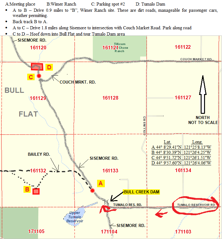
The field trip will involve a visit to the site of the 1914 Wimer Ranch at the south end of Bull Flat followed by a tour of the Tumalo Dam site at the north end of Bull Flat. Bull Flat is located approximately 5 miles due west of the town of Tumalo and can be reached via Tumalo Reservoir Road. Upper Tumalo Reservoir is located at the south end of Bull Flat.
From the starting location on Sisemore Road, we will drive 0.9 miles on dirt roads to the to the site of the Wimer ranch and the original Tumalo Post Office. There we will wander on level ground to see the remaining evidence of the ranch, irrigation canals, and survey markers. Paul Claeyssons will touch on the pre-ranch history. After Wimer we will return to Sisemore Road and drive north 1.75 miles to the Couch Market Road intersection, dismount, and examine the dam site and environs. Bob TImmer will discuss how a miss-understanding of the geology led to the failure of the reservoir.
9:00 AM - Meet at the pull-off on Sisemore Road about 1/4 mile north of the Bull Creek Dam; shown as point "A" on the following map. The trip will conclude around noon.
Two options on traveling from Bend:
- From NW Mt Washington Drive, head west on Shevlin Park Road, continuing on Johnson Road for 4.9 miles to Tyler Road (left turn at sharp curve in Johnson Road. Continue west on Tyler road to "T" intersection with Tumalo Reservoir Road. Turn left and proceed to "T" intersection with Sisemore Road. Turn right, cross the Bull Creek Dam, and proceed 1/4 mile to gathering area on the left side of Sisemore Road. Travel time from Bend is about 30 minutes.
- From Cascade Village Shopping Center, proceed west on Highway 20 to Tumalo. Turn left on Tumalo Reservoir Road (second turn in Tumalo) and proceed to "T" intersection with Sisemore Road. Turn right, cross the Bull Creek Dam, and proceed 1/4 mile to gathering area on the left side of Sisemore Road. Travel time from Bend is about 25 minutes.
Bring:
- Water (lots), snacks, wind breaker
- Boots are recommended for walking around Wimer Ranch and Bull Flat
- Hat, windbreaker and sunscreen
All participants must be vaccinated and must be members of ASCO
Contact: BobTImmer@yahoo.com, Field trip coordinator
%20(002).jpg) Mike Berry is a history enthusiast and a professional land surveyor. He is a 1977 graduate of the Forest Technology program at Central Oregon Community College. His 45 year surveying career includes state, federal, county and private sector work and he recently retired as the Deschutes County Surveyor. In the course of researching various survey projects throughout Deschutes County he often finds himself drawn deeper into the backstory of the men and women who walked these same lands generations ago. He is a board member of the Deschutes County Historical Society and is a past-president of Oregon Association of County Engineers and Surveyors and the Central Oregon Chapter of the Professional Land Surveyors of Oregon.
Mike Berry is a history enthusiast and a professional land surveyor. He is a 1977 graduate of the Forest Technology program at Central Oregon Community College. His 45 year surveying career includes state, federal, county and private sector work and he recently retired as the Deschutes County Surveyor. In the course of researching various survey projects throughout Deschutes County he often finds himself drawn deeper into the backstory of the men and women who walked these same lands generations ago. He is a board member of the Deschutes County Historical Society and is a past-president of Oregon Association of County Engineers and Surveyors and the Central Oregon Chapter of the Professional Land Surveyors of Oregon.